

 This lake always, always freaks me out. I think it is because I know how deep it its. When I was in college, Georgia Power decided to do maintenance on the dam that holds the lake back into Tallulah Gorge. The water level was taken down over 80 feel and there was plenty of lake left to go. Yikes!
It is the fourth in a series of a six lake series that provide electric power to Georgia. Tallulah Falls Lake was formed in 1914 with the completion of the Tallulah Falls Dam, a concrete dam with diversion tunnel. “The diversion tunnel is 11 feet (3.4Â m) wide, 14 feet (4.3Â m) high, and 6,666 feet (2,032Â m) long and was tunneled through solid rock and then lined with concrete. The dam is 126 feet high and has a span of 426 feet (130Â m). The Tallulah Falls Hydroelectric Plant is located 608 feet lower than the dam at the lower end of the tunnel and has a generation capacity of 72,000 kilowatts!”
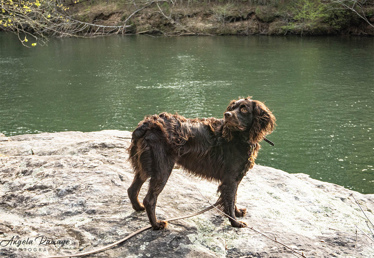
 For many years, a complete lack of improved access allowed little Tallulah Lake to stay in the shadow of its larger companion lakes like Lake Rabun, Burton, Seed and Tugalo. We have paddled all of these easily. My little water Nikon (camera) did pretty good again. Just lots of green water this time. I never know what color the water in this lake will be. It really depends on the sky and the sun’s reflection—or maybe the depth of water! See I scare myself with posts like this!
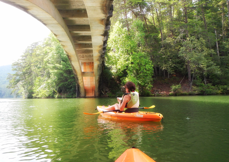 Tallulah Lake provides a very fun paddle with some historic points along the way. It’s my “once a year scary” paddle, and I even managed to freak myself out beneath one of the old 1915 bridges that span the lake.
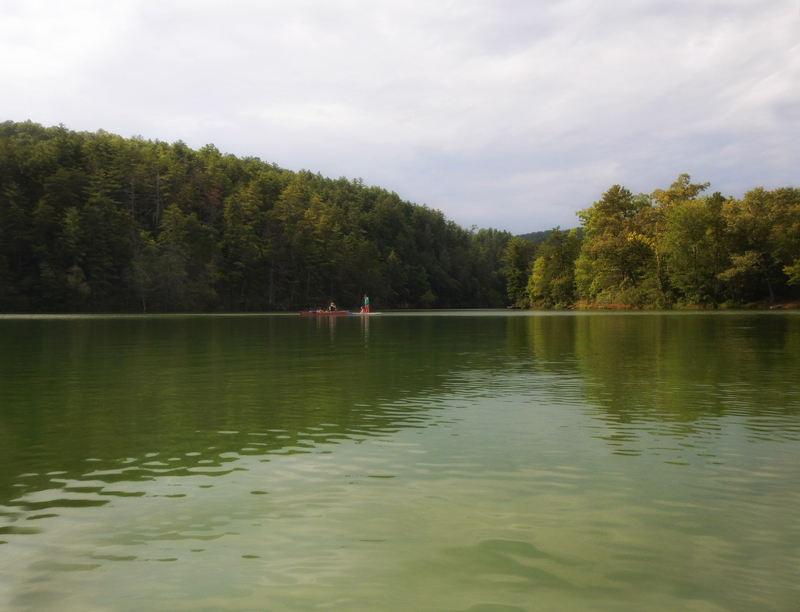 It is located basically at extreme upper end of Tallulah Gorge, a chasm two miles long and nearly 1,000 feet deep. Tallulah Lake is the oldest of Georgia Power’s chain of north Georgia hydropower developments and when you are paddling on it, you suddenly know that you are paddling in a very historic environment. There are plenty of paddle boarders and kayakers on this lake. So you are never alone.
 We paddled along the shoreline so we could see all the extreme rocks and the canoes and kayaks. No boats with anything above a trolling motor are allowed on this lake.
 I’m still taking my own photo!
 Then comes the paddle to the power plant at the north end of the lake and a “total freak out” moment. Paddling near these plants always bring feelings of awe for me. We were very glad the power plant did not start pushing out water while we were near it.
 Here’s some of what is left of the train bed of the Tallulah Railroad that ran along side the gorge and crossed the lake.
 There was lots of green surrounding the shoreline.
 So here is the view! The bridge in the background was the one we were under earlier. The piers were built to carry an old steam engine over the lake. “Tallulah Gorge had been a place of awe to the Cherokee who ruled the region prior to the arrival of European settlers. The thousand foot deep gash in the earth where the Tallulah River rushes toward its confluence with the Tugaloo River is the deepest canyon in North America east of the Rocky Mountains. According to a Cherokee legend reported by an early explorer, the gorge was inhabited by a mysterious hostile race of ‘little people’. They supposedly trick or abduct hapless trespassers into falling to their deaths, or drowning in the raging river at the bottom. Approaching Tallulah Falls from the south, the railroad actually skirted the southern rim of the gorge for a short distance.” Okay, I’m not going to think about all of that or where I was paddling on Saturday!
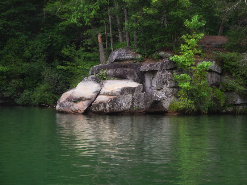 There’s plenty of rocks that provide places to stop off to jump into this lake! It is a very fun paddle. Just know that these rocks are like the ones in the gorge and there’s plenty of space between them and the bottom of this lake.
What a cool look into that area. And, a great little history lesson. Thanks for sharing the photos and description of each.
So if you fell out of your kayak and were pulled under in this lake – your body may never be found?
So if you fell out of your kayak and were pulled under in this lake – your body may never be found? Ahhhh, I am now freaked out too!
Absolutely! Can’t think about how deep these lakes are. Keep your PFD on!!
The is for your blog! Just paddled there yesterday and loved it. Lots of great hidden falls and gorgeous and calm waters.
I wanted to put you at ease over the lake. It’s not 1k ft deep. The gorge is 1k deep and the lake is 1k over the gorge yes. I wasn’t able to find the actual depth of the lake but I have seen video of it when it was drained leaving only the river basin. I’d say the deepest around the dam but likely 40-60ft with the exception of the dam area (maybe 80-120 ft).
The deepest lake east of the Mississippi River is Carter’s Lake in NW ga (450 ft). The rest of Georgia’s lakes are around 180 ft or less.
Thought this might help ease you some the next time you paddled there!
Thanks for your comment! I probably overdo it when I write posts like this but it is just for drama. I did see this lake drained years ago; and while it is not the deepest, it is still freaky—or maybe that is just me. LOL! I stay in my kayak these days and not on an inflatable float like I did in college. Thanks for visiting my blog!!