
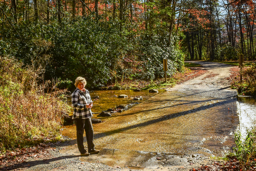
Even thought summer is over, it is still all about the views and the hike. It was much colder and the first thing we encountered on our way up to Albert Mountain was a shallow stream crossing.
I remember after climbing Fry Pan Mountain and the fire tower there, saying that the next thing I would like to do is to climb as many fire towers as possible in North Carolina. The Albert Mountain Fire Tower sits squarely on the Appalachian Trail (AT). So, that location was attractive to us. We know the AT is usually well-maintained and though it was leaf scattered on this day, it was a beautiful short hike.
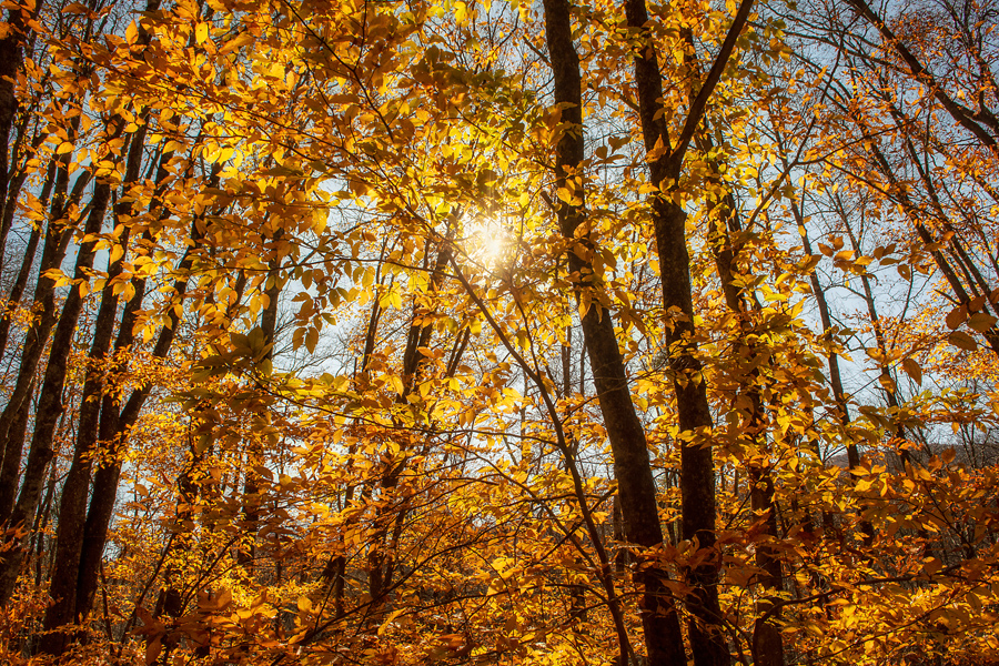
On the way to the trail, and at the lower elevations, the colors were still very impressive.
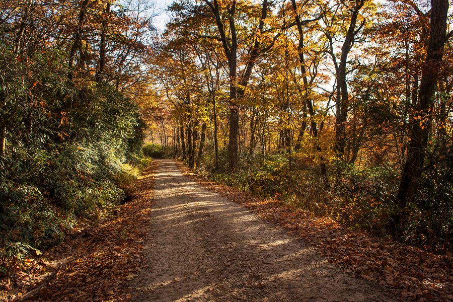
There are two ways to drive up to the trailhead at Albert Mountain. We chose to leave from near Franklin, NC, because we felt this road would be better and take less time. The Forest Road out of Otto, NC, is currently very rutty and difficult to drive with its hairpin curves. The FS 67 road in this photo was perfect, well-graded and easy to travel.

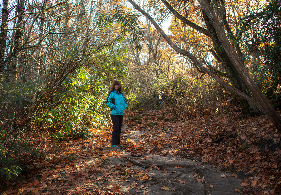
The adventure begins at a gravel parking area off the graveled FS67 in the Standing Indian area of the southern Nantahala National Forest (view maps and driving directions). Once you get out of your car, look for the blue blazes. You will hike through a metal gate to the north, and follow a blue-blazed access trail to the northeast. The beautiful part of this hike (there are many) is how it begins through a dense forest of gnarly-branched rhododendron. I love walking through these “tunnels.”
You reach the Appalachian Trail quickly at .3 mile. Go to your right and begin to follow the white-blazes, which clearly lets you know that you are on the AT.
No joking here: the Albert Mountain trail is a steep ascent, climbing southbound toward the summit. It’s a short trail but it is “strenuous.” That’s what it is labeled, but I did not have a problem with the climb. I did stop once just to “catch my breath.”
Honestly, it is a straight up climb but nothing that was too challenging, especially after climbing Devil’s Courthouse a couple of times this past summer.

There is another moderately challenging 4-mile out-and-back hike that travels a scenic stretch of the Appalachian Trail near Franklin, NC, so you have choices! We would have taken that route, but we got a later than normal start and knew we would racing against a setting sun coming back down the trail.
This is a beautiful stretch of the Nantahala National Forest, and the drive from Franklin, NC, is very scenic. Many who hike the AT say that north Georgia and this part of North Carolina is some of the best scenery. The hike up and back requires some light scrambling over exposed rock – but it’s so worth it. The views are simply unforgettable.
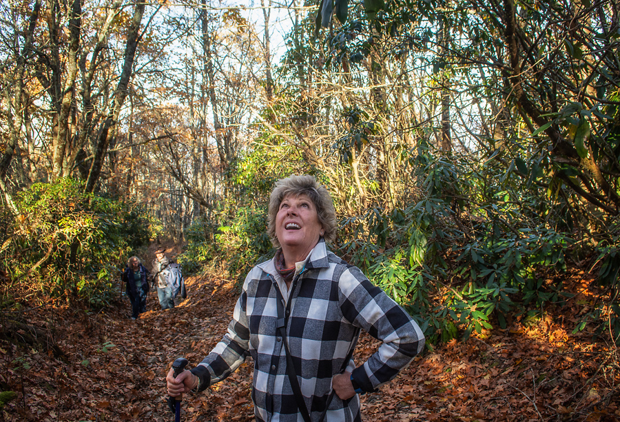
In this photo, Anne is looking up at the fire tower. We had made it to the summit!
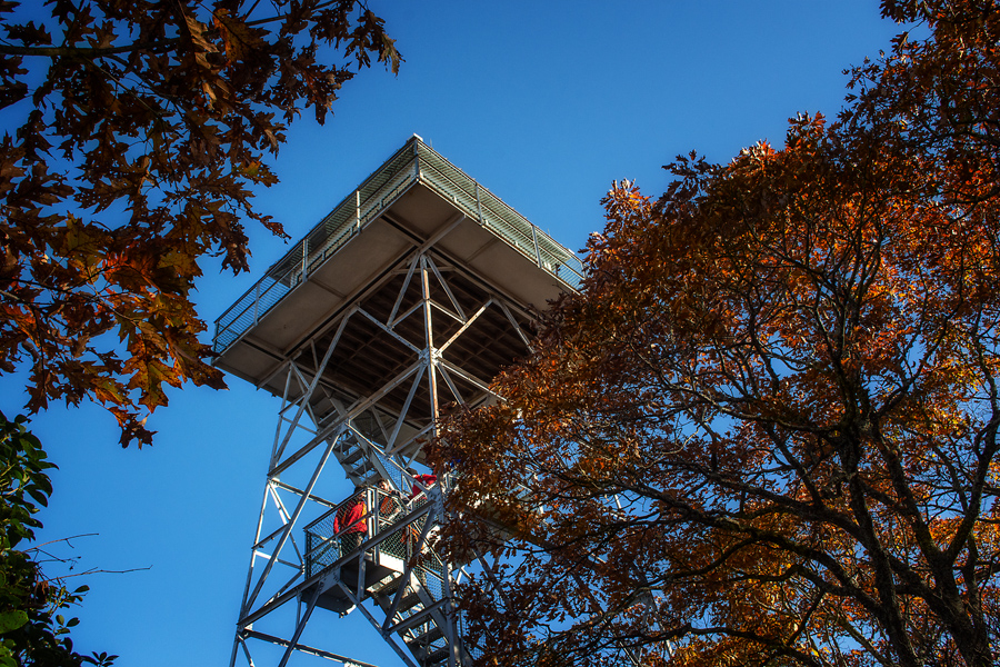
The summit is very interesting. The tower was built in the early 50s to replace an older, wooden structure on Standing Indian Mountain. It’s in great shape though I think I like the one at Frying Pan a little better. I like this trail a lot better but maybe, I like the Frying Pan tower better because it was open. This tower was closed and was once a live-in tower with rangers manning it for extended periods.
I would like to see the tower on Yellow Mountain, but that includes a 12 mile hike to get there, and my legs won’t quite let me do that right now.

I mean, yea, you have to take this photo, right?
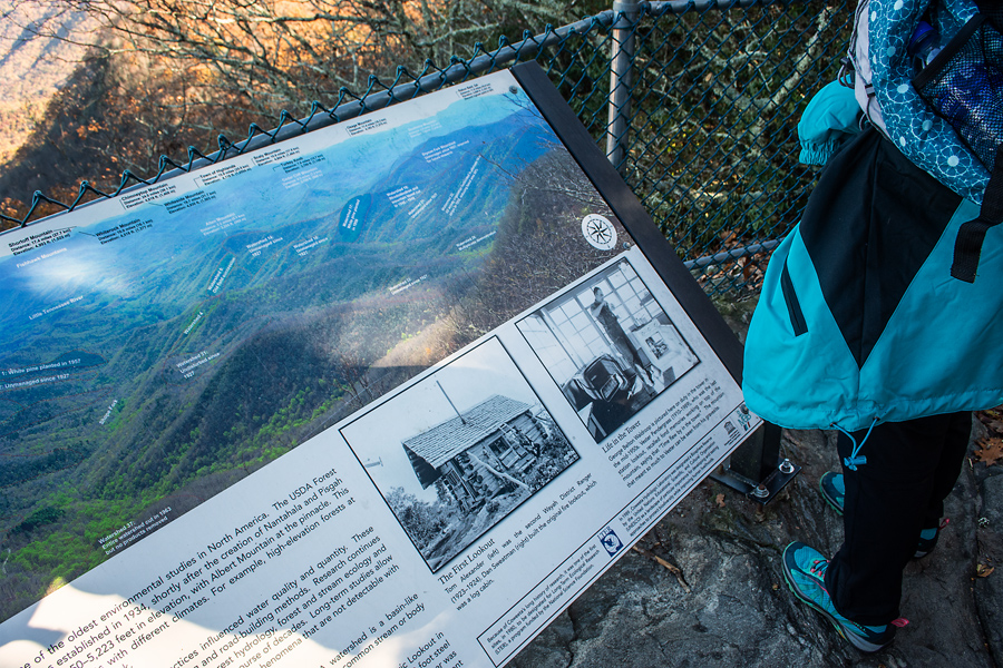
There are so many mountain peaks surrounding us! We stopped to look at the graphics and to recount all the mountains we have climbed. Then we said, “Let’s go climb this tower!”
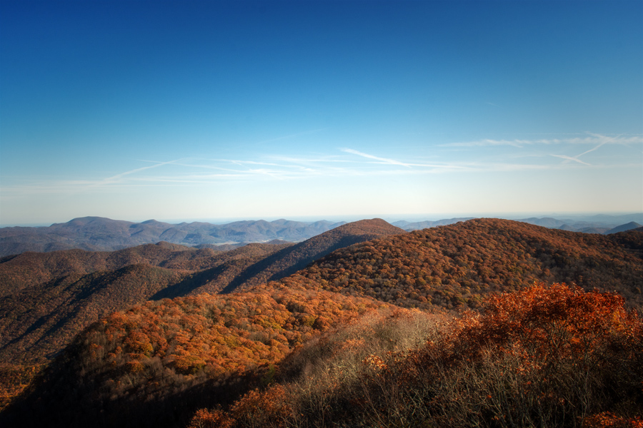
We were not disappointed with the views. . . . But tell me what is missing?! The deep blues of the Blue Ridge are gone for now. The mountains are beginning to winter, and we’ll have to winter with them. No choice in this matter! (smile)

We were up over 5,900 feet—almost to my 6,000 foot “love.” I cannot explain it but if I’m up over 6K, my body feels absolutely wonderful. This view was pretty cool. Pat says it is “framed!”
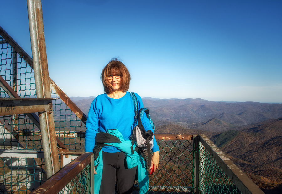
She climbed up the final steps with me and posed for photos. I will point this out: there is no one, like a ranger, around to tell you not to do crazy things. At Frying Pan, we saw people doing very dangerous things. Fearless but not smart things like climbing outside and along the metal railings!
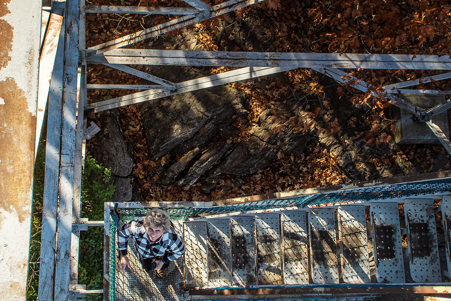
This time Anne made it to the first landing. I understand having a fear of heights. I once hated the thought of climbing something like this, but once again, cancer changed me. Now, I press on telling myself that few things are more dangerous than chemo!

I saved this view for the last. The mountains in the background are “our” Balsam Mountains: Black Balsam, Tennent, and Sam’s Knob. Beloved indeed! I stood for a moment looking longingly at them. Of course, we’ll try to find a way to visit that area in the winter but weather then is pretty brutal and usually the BRPW is closed.

Back on the ground we quickly found ourselves on the AT heading north. Anne asked me where people camp in places like this, and I showed her little openings in the forest where people had made campsites. My friend Amy would have trekked through this area but I don’t think she camped here. Or at least, I don’t remember her writing about it in her online AT Journal. Most people keep moving north on the AT, they know they have a destination to reach—Maine and Mt. Katahdin and you have to do that before October!

Leave A Comment