
Click on photo to enlarge.
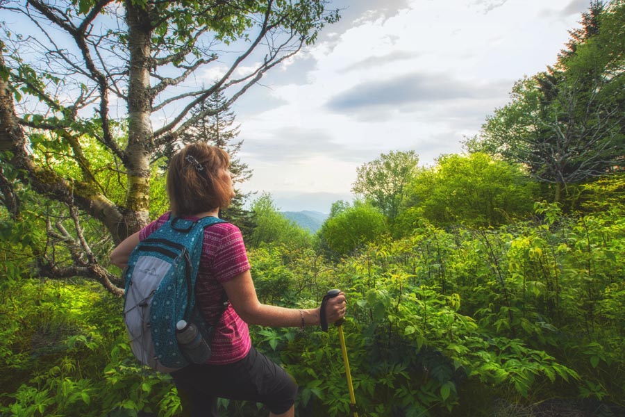
I read the reviews for this 3.6 mile hike to Andrews Bald, and everyone, who seemed much younger than me, wrote things like: “Such an easy hike.” Then someone my age popped in and said. “Moderate.” LOL! It really is moderate—not strenuous but certainly moderate. Why, the rocks on the pathway.
The trail to Andrews Bald begins at the Clingmans Dome parking lot, which is already over 6,000 feet, if that helps to paint the picture. The hike is down along well-placed large rocks for probably .4 of a mile. Then things do turn rocky and you lose close to 1,200 feet on the way down. Remember you have to gain that same amount on the way back out! But this is pretty normal in these mountains.
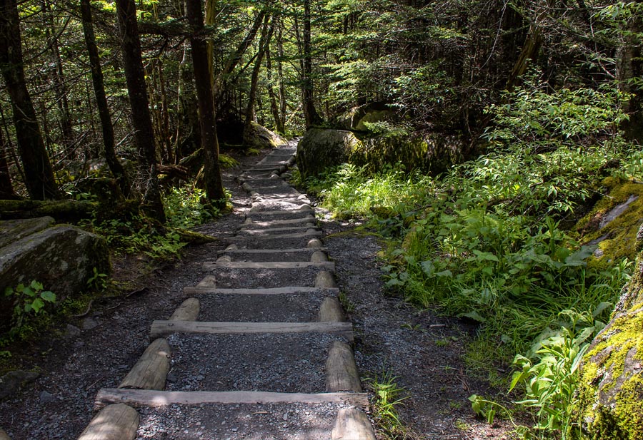
The Forestry Service did design the beginning of the hike with large gravel steps (above). The trail maintenance is wonderful, and it is one of the most beautiful hikes I have been on but of course, Black Balsam, Tennent, and Sams Knob remain favorites. There is something pretty amazing about these mountains. We have hiked to Mt. Collins and now Andrews Bald, so I think we are conquering the Clingman Dome area.
I always try to write whether a hike is family friendly or not. This one is because I saw several children easily moving along the trail to the bald. One even stopped and climbed a huge rock so we could see his strength!
It’s a two to three hour hike with no stopping. So much depends on your ability with a hike like this one; and of course, we stopped at the bald for a while. We had great afternoon sun, and we spent more time than most do on a trail. This is because we have cameras.
I did notice several people sitting on large rocks resting on the way out. So, my word to anyone hiking this path for the first time is to hike your own hike! The views at the bald are well worth the effort to get there.
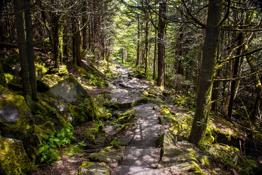
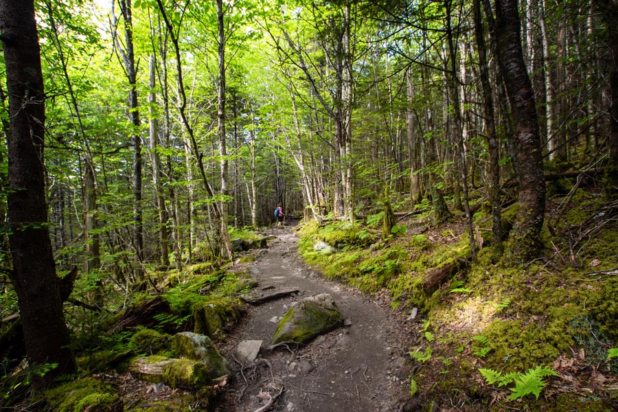
This one section reminds me of the upper trail at Graveyard fields. It could be the light and the narrowness of the pathway.

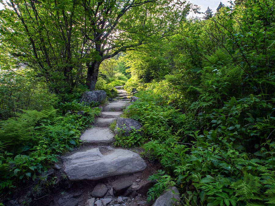
But then you step out into the sunlight and it feels a little like Sam’s Knob! Oh, these crazy North Carolina mountains!
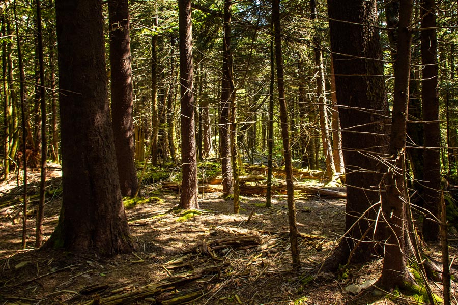
Back in the deep woods and you are sure that you are on Yellow Face!
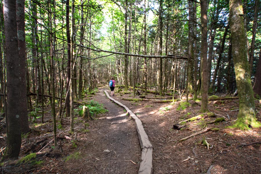
But then you see a trail like this one and you know you are on a pathway that is really cared for. These are long and fairly wide logs that have been split in half and placed in the ground so hikers can move quickly without bogging in the mud during rain!
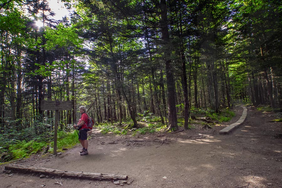
Anne is standing in front of a trail sign. There are a couple of trails that go off and around Andrews Bald. This is the intersection of one. Be sure to just hike the main trail to begin with. Then if you are super strong like many of my FB friends, you can take another trail that will add several miles to your day. (smile)
When you get to the top of NC balds, you know you are in a different place in time. For one thing, Andrews Bald is located deep within the Great Smoky Mountain. Enough said!
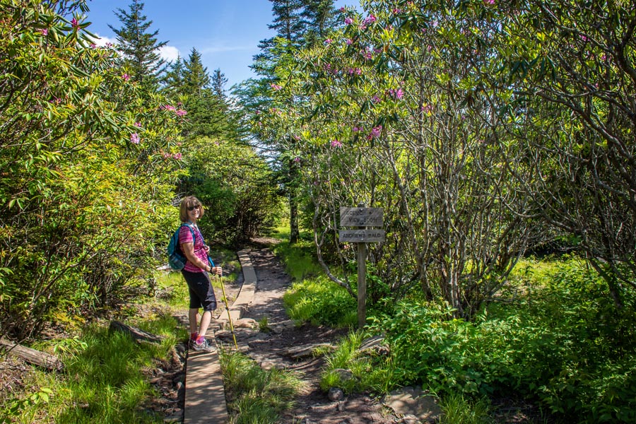
Second, it is just too beautiful for words! Andrews Bald is one of several “balds” in Great Smoky Mountains National Park, which are so named because they are mountaintops that are not covered by trees, but are instead covered by grass, rhododendron, and mountain laurel.
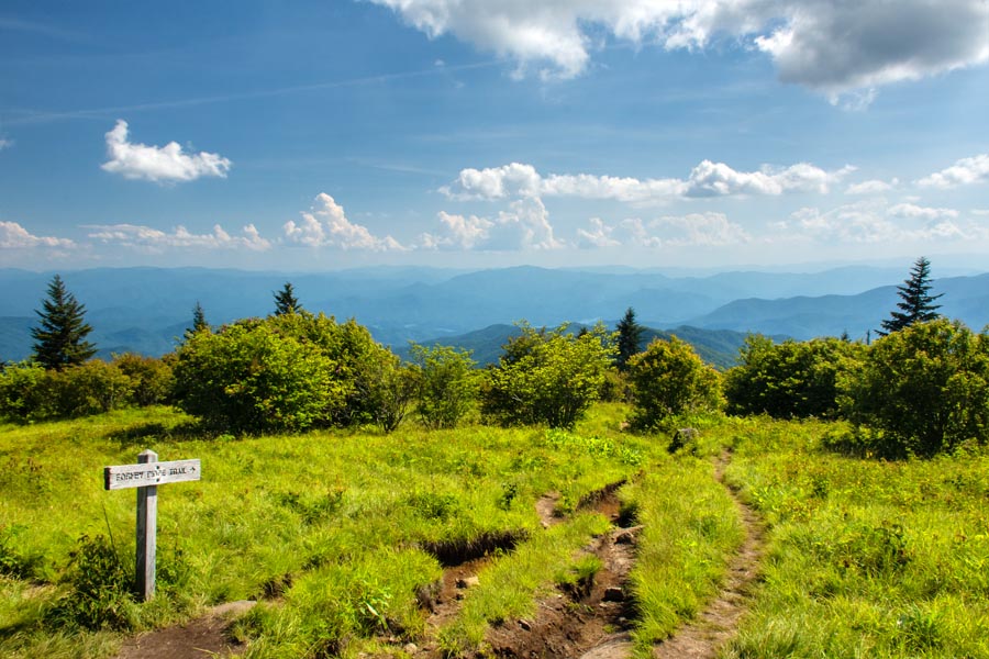
From Andrews bald, you have panoramic views of the southern half of the park, including Fontana Lake (visible in this photo). Wildlife sightings, including black bears, are also possible though we did not see any on this hike.
When you are in western North Carolina, you are in bear country. It’s a given. I did have one little bird follow me from place to place. He even landed at my feet and stayed there until I gave him crumbs from my pita chip! Crazy!
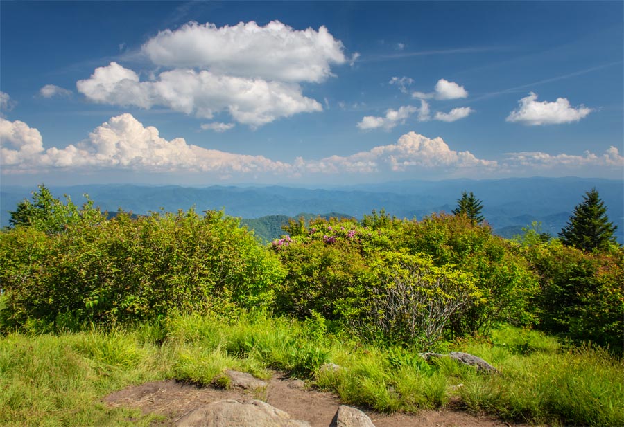
Another view from the top along with the Rhododendron that’s native to the bald
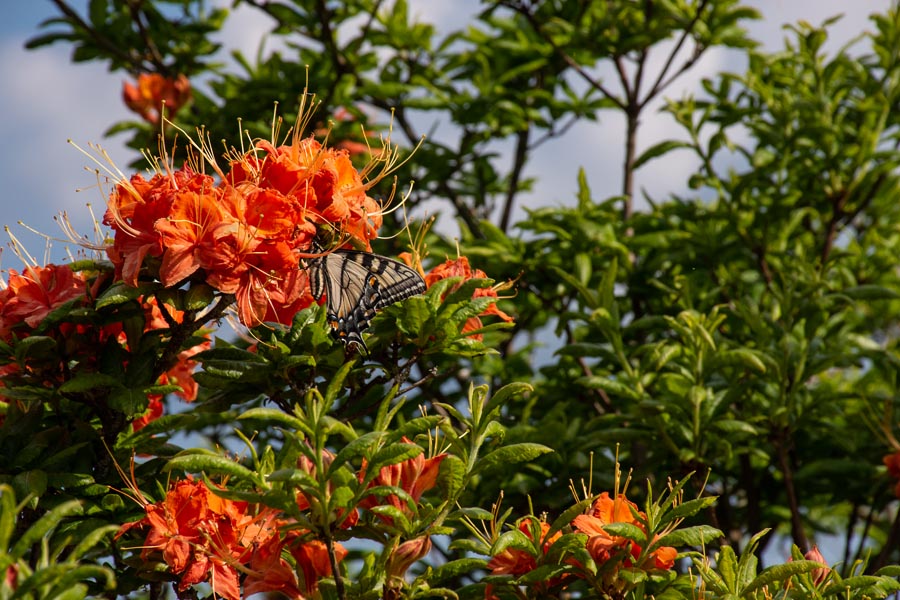
Native azaleas—bright with color—”rim” the bald.
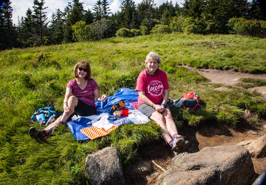
And we had a wonderful picnic to celebrate being cancer free for the third year! Yeah! NED! Thanks, Anne!
I don’t take life for granted any more. I refuse to get caught up in moments of hate and anger that seem to be spreading around our globe. I had an ER moment three years ago, and that did it for me.
God shook me to the core and I knew if He allowed me to live, I would live my life totally and completely for Him. I have tried to do this for almost 40 years, but there’s something about a cancer diagnosis that sharpens your perspective. Mine is razor sharp these days!
It was time to head back; and yes, it was all up hill. We met several people hiking to the bald with tents and overnight camping gear. I can’t wait to be under the stars on Black Balsam. (Let’s see if anyone from my group reads this post and comments.) We are going to photograph the Milky Way this year! So, grab a tripod!
Finally, one last look out at the mountains that surround this area. Next time we are here, we’ll hike the AT from the Forney Ridge Trail to the top of Clingmans Dome. That will be fun!
Forney Ridge Trail to Andrews Bald
Driving to the Trailhead: Drive to the Clingmans Dome parking area at the end of Clingmans Dome Road. Look for a short access trail down to the left between the bulletin board and the paved trail to the Clingmans Dome Information center and Clingmans Dome tower.
Hiking Distance: 1.8 miles one way to Andrews Bald. Forney Ridge Trail continues past Andrews Bald for a total of 5.6 miles down to Springhouse Branch Trail.
Trail Conditions: Elevation change of 1,200 feet
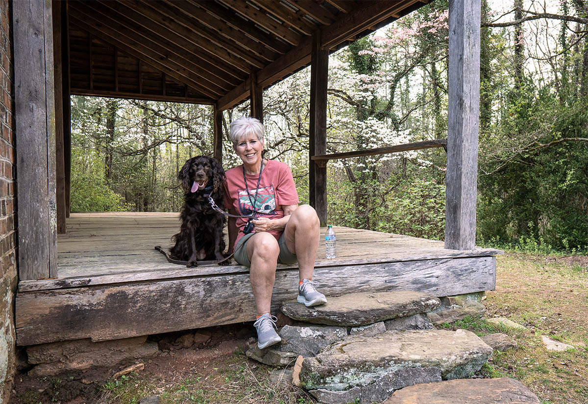
NOTE: Pets are not allowed on this trail. The only two trails in the park that allow pets are the Gatlinburg Trail near the Sugarlands Visitor Center and the Oconaluftee River Trail near the Oconaluftee Visitor Center. Learn more about pet restrictions in the park.
Beautiful post. I enjoyed the trip